Thank you for visiting the Ocean Planning and Renewable Offshore Energy Virtual Open House. This site is designed to provide citizens and stakeholders, who were not able to attend the Ocean Planning and Offshore Renewable Energy open houses conducted in April 2010, the opportunity to access the information shared at the events.
The two public open houses were hosted by the Maryland Department of Natural Resources and the Maryland Energy Administration to discuss the future of our ocean and to provide citizens an opportunity to learn about the State’s ocean mapping and planning efforts, with a focus on offshore renewable energy. The open houses were designed to allow citizens to ask questions and provide feedback at their own pace. Experts from both agencies and project partners were on hand to answer questions and provide information about ocean mapping and planning, offshore wind, project timelines, anticipated processes and opportunities for community response.
Since the Fall of 2009, DNR has worked with resource experts, user groups, The Nature Conservancy (TNC) and the Maryland Energy Administration (MEA) to compile data and information about habitats, human uses, and resources in Maryland’s Atlantic Ocean. Using the state’s foundation of ocean data and information, ocean planning can help identify areas most suitable for various types of activities in order to reduce conflict among uses, facilitate compatible uses, and reduce environmental impacts to preserve crucial ecosystem services. |
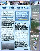
Download Coastal Atlas Fact Sheet
|
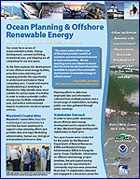
Download Ocean Planning Fact Sheet
|
Offshore wind has the potential to be an ocean use that will require the State to balance multiple uses in the ocean. Maryland’s ocean planning approach to address this potential use is based largely on engaging stakeholders to gather information about our ocean resources and mapping the best data available. |
This Virtual Open House will:
- Show maps and provide information about Maryland’s Ocean resources, human uses, and planning efforts
- Link to Maryland’s Ocean mapping tools
- Describe what Maryland is doing about renewable energy and how potential sites could be identified
- Provide the opportunity to comment

Instructions:
We recommend that you work your way through poster display starting with the Welcome Table. Click though the numbered thumbnails (1-29) to display the posters in the order they were presented in the April open houses.
We highly encourage you to access our Ocean Comments database to submit questions and comments. Definitions are provided at the Welcome Table. Feel free to click that link at any time to access that resource.
