Drinking Water Source Protection
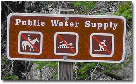 Protecting our drinking water supply relies on many efforts by many different local, state, and federal agencies, including running effective filtration and water supply systems, limiting human activities near and on reservoirs, avoiding and minimizing spills and pollutant releases, and monitoring a range of water quality parameters. Efforts by MD DNR Forest Service concentrate on how to maximize the role of forests in protecting sources of drinking water.
Forests are an important tool in long-term, low-cost protection of water supplies. Concentrations of nitrate from forested watersheds typically average 1 mg/l or less, compared to a drinking water standard of 10 mg/l. Runoff from watersheds dominated by other land uses such as agriculture or development is often 3 to 15 times as much. Work has focused on the 1) location of forests, and 2) condition of forests. Maintaining forest cover in critical locations such as floodplains, seeps, steep slopes, headwaters, and close to streams can help avoid major deterioration in water quality and increases in treatment difficulty and cost. Forests adjacent to consistent nutrient sources (such as fertilized crops or lawns) can reduce nitrogen before it reaches the reservoir, especially on shallower soils where tree roots reach the groundwater. The condition of the forest also affects ability to protect water quality. Forest condition includes characteristics such as tree health, distribution of tree and stand sizes and ages, and number of layers of vegetation (e.g., herbaceous, shrub, subcanopy, midcanopy, upper canopy). Disturbances such as windstorms or hurricanes are infrequent but inevitable. Stands with multiple layers of vegetation and a range of ages and sizes of trees can withstand loss of trees most susceptible to damage without losing all of its functions for erosion control and infiltrating water. Forest management near reservoirs takes into account the potential for multiple canopy layers, matching species to site conditions, and opportunities to maintain actively growing forests next to nutrient sources. Landowners can help improve water quality by planting trees on their own land. Even a  backyard forest can help protect watersheds used for drinking water sources.

Baltimore City Comprehensive Forest Conservation Plan
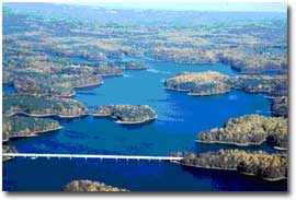
Baltimore City supported the development of a Comprehensive Forest Conservation Plan for the 17,856 acres of city-owned land around the three reservoirs, Loch Raven, Liberty, and Prettyboy, which supply 1.8 million people in Baltimore City and surrounding areas with drinking water. The management plan, really more of an adaptive management system for the forest lands, identifies methods of meeting the primary goal of protecting water quality with subsidiary goals of supporting regional biodiversity and habitat and local recreation. The plan was developed using an ecosystem approach, evaluating many different components of the forests, from the smallest plants on the forest floor to the largest trees and the many layers possible in between, and mapping elements that affect water quality and wildlife, including roads, streams, seeps, woody debris, rock piles, caves, crevices, and snags. Since many conditions from outside the property boundaries affect the city-owned watershed lands, and ecosystems are dynamic in nature, an active management approach is needed to meet the goals for water quality, biodiversity, wildlife, and recreation.
The field work for the project has established all road locations and conditions, location and condition of stream crossings, stream condition based on a random sample of half of the streams, as well as the basic forest data fundamental to a forest management plan, such as forest stand boundaries, stocking (trees/acre), basal area (sq. ft./acre), species, size classes, and age. Findings of the assessment include:
- A diversity of forest stand types, but less diversity in stand ages;
- Very little seedling regeneration in many stands;
- A forest fragmented by many interior roads and sinuous lake edge;
- Road crossings with flow or fish blockages common; and
- Problems with invasive species limited to stand edges.
Management actions recommended by the plan include:
- Marking boundaries to clearly delineate property ownership and purpose;
- Controlling deer browse to enhance seedling regeneration;
- Establishing deer exclosures to determine potential levels of regeneration;
- Conducting small regeneration cuts to stimulate growth of young trees;
- Managing stands over shallow groundwater adjacent to nutrient sources in active growth phases (80 years or less);
- Managing stands poorly suited to the soil type to transition them to species better adapted to site conditions;
- Establishing Biodiversity reserves in selected areas of contiguous forest, and removing some nonessential roads to further reduce effects of fragmentation, and
- Establish a permitting system to assure recreational use compatible with water quality priorities and allow efficient distribution of information on minimizing impacts to water quality.
Gunpowder/Patapsco Source Water Protection
The Gunpowder project is built upon the approach and findings of the Baltimore City Reservoirs Comprehensive Forest Conservation Plan. The Gunpowder project extends the focus from just the City-owned lands, which comprise only 7% of the basin, to consideration of the entire watershed. Streams integrate effects from all the lands that drain into them, so evaluating conditions throughout the watershed is needed to assess current and future needs for source water protection. Land uses throughout the watershed have effects beyond their boundaries, such as activities that generate excess nutrients (most of what we do), or addition of food sources and suppression of predators that encourage record high deer populations, or spread of invasive plants. At an even larger scale, prevailing winds bring atmospheric deposition of acidity and excess nutrients from hundreds of miles away.
The Gunpowder project has refined information on forest cover and streams where needed in the watershed, established demonstration forest buffers along streams and wetlands, and identified some suggested areas where forest restoration and conservation could prove most beneficial to water quality protection for the reservoirs. Word about the project and the link between forests and water quality protection has been spread through local organizations, such as the Friends of Carroll County, the Upper Western Shore and Patapsco/Back Tributary Teams, and the Gunpowder Valley Conservancy.
The Gunpowder project has helped support related watershed-based efforts, including the Trust for Public Land’s (TPL) Protecting the Source Initiative at Prettyboy Reservoir and the Carroll County Liberty Reservoir Watershed Restoration Action Strategy. Digital data from remote sensing are widely available in Maryland, but these sources do not capture many of the smallest streams, difficult to detect at the scale of these assessments, that can have large effects on water quality. The more refined data from field observation and soil and detailed topographic mapping supported by the Gunpowder project identified 30% more streams and forests than the previously available digital data. This improved resource data, as well as active local watershed and conservation groups, help single out the Prettyboy Reservoir for selection as one of TPL’s four national models to develop a locally-led process of land conservation to protection drinking water source watersheds, funded by EPA. Watershed Restoration Action Strategies, being developed in priority watersheds such as the Liberty Reservoir as a followup to the Clean Water Action Plan, also benefit from the more detailed mapping, an aid to local jurisdictions in setting priorities for improving watershed health.
Patuxent Reservoirs Forest Conservation Plan
 A Comprehensive Forest Conservation Plan is being developed for Rocky Gorge and Brighton Reservoirs, drinking water sources for Washington D.C. and surrounds, on over 6,000 acres of Washington Suburban Sanitary Commission land. The approach is similar to that used for the Baltimore City plan, and incorporates coordination of forest cover assessment and conservation with surrounding jurisdictions, several of whom have forest conservation initiatives at the county or city scale.
The plan will be developed using an ecosystem approach, evaluating many different components of the forests, from the smallest plants on the forest floor to the largest trees and the many layers possible in between, and mapping elements that affect water quality and wildlife, including roads, streams, seeps, woody debris, rock piles, caves, crevices, and snags. Since many conditions from outside the property boundaries affect the watershed lands, and ecosystems are dynamic in nature, an active management approach is needed to meet the goals for water quality, biodiversity, and recreation.
