Trails and Trail Maps
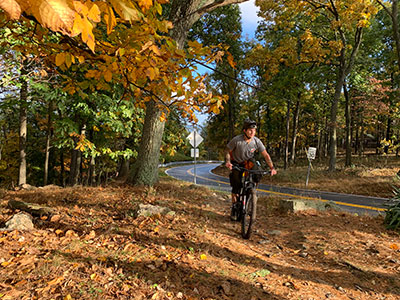
Gambrill has over 16 miles of trails for hiking, mountain biking and horseback riding.
All trails begin at the trailhead parking lot on Gambrill Park Road, between the Rock Run area and the High Knob area. If parking at the trailhead is full, visitors must continue up the mountain to High Knob. Many trails can be accessed throughout the High Knob area. Trail maps are available at the nature center bulletin board.
Many of the trails feature great views. Due to the rocky terrain and steep hills, most of the trails are rated moderate to difficult. However, the White Oak Trail is an easy one-mile loop trail, which makes it a good choice for families with small children.
Pets are allowed on the trails, but must be kept on a leash at all times.
All trails close at sunset.
 Horseback Riding
All trails are open to horseback riding with the exception of the White Oak Trail, which is restricted to hiking. Parking for horse trailers is limited. The Maryland Park Service does not rent horses, and only provides the trails as a means of recreation.
While all trails are open to horseback riding, with the exception of the White Oak Trail, horseback riding is discouraged due to the recent vegetation growth on the trails. If you are interested in volunteering to help maintain the trails, please contact us at
Gambrill.StatePark@maryland.gov.
Trail Descriptions
-
White Oak (1 mile) – Easy – White blaze – This easy trail is open to hikers only (no mountain bikes), and is a good choice for families with small children.
-
Red Maple (1 mile) – Easy – Red blaze – Fairly easy to walk, this trail connects the campground with the rest of the park. One short section of the trail is somewhat steep.
-
Green Ash (2 miles) – Moderate – Green blaze – Visitors seeking an adventure love this trail. There are several steep slopes and very little level ground, making this trail a challenge.
-
Black Locust (3 miles) – Difficult – Black blaze – This trail truly showcases the beauty of Gambrill State Park, from its wooded slopes to the breathtaking views of both Frederick to the east and Middletown valley to the west. The trail passes through the High Knob scenic area, mixing several steep slopes with fairly level areas.
-
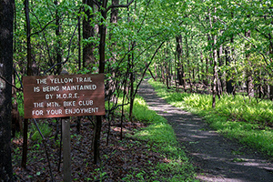
Yellow Poplar (7 miles) – Moderate – Yellow blaze – The longest of the Gambrill trails, this trail is only moderately difficult. Visitors who have several hours can hike up the mountain and out into the far reaches of the park. Enjoy the view from North Frederick Overlook as you continue north along a moderately sloped ridgeline walk.
-
Catoctin National Recreation Trail (28 miles) – Difficult – Blue blaze – This trail traverses Gambrill State Park, the Frederick City Watershed, Cunningham Falls State Park and Catoctin Mountain National Park. It ends at Mt. Zion Road, 1.3 miles north of Owens Creek Campground in Catoctin Mountain National Park. The Appalachian Trail may be reached by traveling west on Mt. Zion Road for two additional miles to Raven Rock Road. Backcountry camping on the Catoctin Trail is not permitted. Family camping is available at Gambrill State Park, Cunningham Falls State Park in the Manor and Houck Areas and Catoctin Mountain Park. The Potomac Appalachian Trail Club maintains this trail.
Parking for Catoctin Trail
Overnight parking for Catoctin Trail through hikes is only permitted with prior approval from Gambrill SP staff. Any vehicles left overnight may receive a citation. To request permission, please email
Gambrill.StatePark@maryland.gov. Be prepared to give:
- Your Name
- Your Phone Number
- Vehicle Make, Model, & Tags
- Emergency Contact Name
- Emergency Contact Phone Number
- Overnight Accommodations
