Whether you are a curious citizen, student with a project, consultant, or a planner, you came to this page to get data. Here's a quick list of information we have, depending on what you are searching for.
- If you are interested in what is going on in the stream in your backyard:
- If you are interested in the protocol used in our projects:
- If you are interested in the raw data for a research project:
The data collected by the MBSS from 1995 to present cover the major river basins in the State. Here is the
 MBSS Data Users Guide. The data have undergone quality control checks and are available by completing a
Data Request Form. If you have questions or comments about the process, please email Katherine Hanna at
katherine.hanna@maryland.gov.
MBSS Data Users Guide. The data have undergone quality control checks and are available by completing a
Data Request Form. If you have questions or comments about the process, please email Katherine Hanna at
katherine.hanna@maryland.gov.
Katherine Hanna
Maryland Department of Natural Resources
Monitoring & Non-Tidal Assessment Division
580 Taylor Avenue, C-2
Annapolis, Maryland 21401
Email:
katherine.hanna@maryland.gov
Products and Applications of Our Data
The Monitoring and Non-Tidal Assessment Division has conducted many various research projects with its data, and it is used to assess current managment protocols, influence policy, and initiate further study. This area details what happens to the data after it is collected, what it has been used for, and what it is being used for now.
Products and Applications of MBSS Data
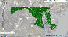
Interactive Maps
The Monitoring and Non-Tidal Assessment Division has collected data from around the state regarding several different research projects. These data have been utilized to create maps (both static and dynamic) that graphically represent the results.
Click Here for Interactive Maps
Maryland Maryland Department of Natural Resources Data
-
 MERLIN is DNR's online mapping tool, best used with a high-speed internet connection. Many Water Quality sampling sites are included in the MERLIN data. Once you get into the main mapping screen, choose the 'special projects' button and choose the 'water quality sampling stations' button. It takes some time to load, but the dots are on the map. You will have to use the "InfoTips" feature tab on the left side to find out which dot is what site, but you can zoom in and out to whatever scale you want.
-
 https://imap.maryland.gov/Pages/default.aspx to download some of the datasets behind MERLIN.
-
http://www.mgs.md.gov/index.html for information on USGS topographic maps and other topics that may help you.
Other Maryland State Agency Data
- Other Water Quality data is available by using the "Data Hub" button on page:
http://www.chesapeakebay.net/ The data at this site is from many programs, and it is recommended that you read the "meta-data" before using the data.
-
http://mde.maryland.gov/PROGRAMS/WATER/Pages/index.aspx is Maryland Department of the Environment's WATER INFORMATION CENTER.
- All state regs are up on the State Documents web site
(http://www.dsd.state.md.us). The water quality standards are in 26.08.02. The Stream use designations are in 26.08.02.08 and are listed by 6-digit basin codes. (COMAR Title 26,Sub-Title 08, Chapters 01,02,03,04,08 deal with water quality regs.)
USGS Water Quality Data
Water-quality data from the National Water Information System (NWIS) of the U.S. Geological Survey (USGS) can be readily accessed online in a comparable format to data housed in the Storage and Retrieval (STORET) water-quality system of U.S. Environmental Protection Agency’s (USEPA).To access the USGS water-quality web service, please go to
http://qwwebservices.usgs.gov
The USGS water-quality web service provides data from the NWISweb database
(http://waterdata.usgs.gov/nwis), which hosts 4.3 million samples and 72 million results representing approximately 368,000 sites across the United States from over a century of monitoring.
http://water.usgs.gov is the USGS home page for Water Resources of the United States
USGS provides science for a changing world. For more information, visit
www.usgs.gov.
US EPA Data
The USEPA water-quality web service provides data from the STORET data warehouse that contains biological, chemical, and physical data on surface and ground water collected by federal, state and local agencies, Indian Tribes, volunteer groups, academics, and others
(http://www.epa.gov/storet/web_services.html). All 50 States, territories, and jurisdictions of the U.S. are represented.
General Water Science information, with links to many other EPA water-related sites is available on page
http://www.epa.gov/waterscience.
http://www.epa.gov/surf for the EPA Surf Your Watershed home page
