There are too many questions about freshwater streams for one monitoring program to answer all of them. How is the "stream in my backyard" doing? Where does the pollution come from? What IS the pollution? How did it get that way? How long have things been this way? What lives in the water? Where did all the migratory fish go? Why? Whodunnit? What can I do to help?
- Maryland Biological Stream Survey:
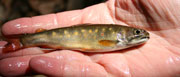
The Maryland Biological Stream Survey looks at many streams each year in order to answer questions about "the stream in my backyard".
- Volunteer Monitoring

Volunteers help to link the community to the health of the local rivers and streams. They are a vital part of the education of the public on their aquatic resources. Check out this section for more information about the Maryland Stream Waders, one of the most popular programs offered by DNR. Each year, volunteers survey all over the state collecting data to examine the health of the streams in their backyard.
- Water Temperature
For stream dwelling organisms, water temperature is an important variable determining species presence/absence and community structure. Fish and benthic macroinvertebrate species have temperature ranges in which they can survive. When water temperatures exceed the upper level of a species, their numbers in a stream will decline. The Maryland Biological Stream Survey monitors stream water temperature using instream temperature recorders. Temperature data from this survey has been used to identify coldwater stream reaches, monitor cold and warm water fish communities, and track potential climate change trends in the state.
 EPA National Rivers and Streams Assessment
From 2008 to 2009, the Maryland Department of Natural Resources Monitoring and Non-tidal Assessment Division (MANTA) and the Interstate Commission on the Potomac River Basin (ICPRB) participated in the U.S. EPA’s National Rivers and Stream Assessment (NRSA). The survey is a blend of the earlier wadeable stream survey (WSA) and the first attempt at assessing non-wadeable streams and rivers. The survey is one of a series being implemented to periodically make statistically-valid and environmentally relevant reports on the health of the nation's waters. Check out this Fact Sheet for more information.
- Long-Term Water Quality
Long Term Water Quality Monitoring has occurred at 54 locations on major (4th order and larger) non-tidal portion of Maryland's rivers since 1976. Sampling at these stations provides the data to determine trends in water quality constituents commonly associated with urban and agricultural land use.
- Acid Deposition:
Explore one of many problem pollutants in our streams.
- Atmospheric Deposition
Particles from smokestacks, car exhausts, and dust can fall to the ground and accumulate in streams and rivers. They can affect the water's chemistry and alter the health of the surrounding communities.
- Geomorphic Assessment
The way we use the land areas in the state has direct implications on the stability and ecological health of stream and river corridors. Understanding these implications involves the measurement of the land surface, sediment flux, and water flow through the landscape.
- Synoptic Surveys
Synoptic surveys are comprehensive water quality surveys designed to provide a snapshot of the nutrient levels and the quality of the biological community in a specific watershed. The surveys typically collect surface water grab samples during spring baseflow at stream confluences, road crossings, or at randomly selected stations within a designated watershed. Samples are analyzed for dissolved nutrients, nitrate (NO2), nitrite (NO3), and orthophosphate (PO4), and biological indices calculated from benthic macroinvertebrate and fish samples. Nutrient concentrations and yields, and biological indices are mapped upstream of all sample sites. Watershed areas between, or upstream of sample sites, average approximately 300 hectare (700 acres).
The synoptic information is an effective tool used by watershed managers to identify subwatersheds or reaches within a watershed that might benefit from the implementation of best management practices, stream restoration, or protection. Sixteen synoptic surveys have been completed by the Watershed Restoration Division of DNR with support of EPA 319 funding in Maryland.
The original (1987) Maryland Synoptic Stream Chemistry Survey Design Report
The 1988 Maryland Synopic Stream Chemistry Survey Report on Estimating the Number and Distribution of Streams
Affected by or at Risk from Acidification
- Stream Corridor Assessment (SCA)
The Stream Corridor Assessment (SCA) survey was developed by DNR's Watershed Restoration Division as a tool to help environmental managers identify environmental problems and prioritize restoration opportunities on a watershed basis. As part of the survey, trained personnel walk the watershed's entire stream network and record information on a variety of environmental problems that can be easily observed within the stream corridor. Common environmental problems documented in the survey include: eroding stream banks, inadequate stream buffers, exposed pipes, altered stream channels, fish migration barriers, pipe outfalls, in-stream construction sites and trash dumping locations. In addition to identifying the location of common stream problems the survey also collects information on both in- and near-stream habitat conditions so that comparative assessments can be made of the condition of different stream segments.
SCA Reports and protocol manuals can be found on the publications page.
