 |
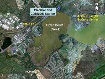
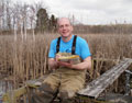
Station: Otter Point Creek weather station
Position: 39° 27.047’ N, 76° 16.474’ W
Description: Located in Otter Point Creek, Bush River.
Years deployed: 2004 – present |
 |
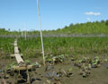
Station: Otter Point Creek
Position: 39° 27' 2.52 N, 76° 16' 28.56 W
Description: Located in the tidal freshwater system of Otter Point Creek, Bush River. Real time telemetry.
Years deployed: 2003 – present |
Where to Find the Data!
Otter Point Creek CONMON water quality data can be downloaded from:
- NERRS Centralized Data Management Office website: http://cdmo.baruch.sc.edu/
- Maryland Department of Natural Resources “Eyes on the Bay” website: http://mddnr.chesapeakebay.net/eyesonthebay/index.cfm.
Otter Point Creek weather data can be requested by contacting CBNERR-MD Research Coordinator, Patricia Delgado: (pdelgado@dnr.state.md.us) or Research Assistant Lindsay Carroll (lcarroll@dnr.state.md.us).
Explore and learn about the interesting research and long-term monitoring projects we are conducting at Otter Point Creek (Bush River), Jug Bay (Patuxent River), and Monie Bay (eastern shore). Our projects range from water quality monitoring to marsh plants to monitoring secretive marsh birds and fish.
We invite you to use our data to support research, modeling, management, and/or education goals. Our data could serve as baseline information to start a new research project, to look for interesting trends, to support modeling efforts, or to complement a project already in progress. We hope our data can help you to make a difference!
Monitoring Climate Change
Stay tuned for this new addition to our website!
Resources
Stay tuned for this new addition to our website!
